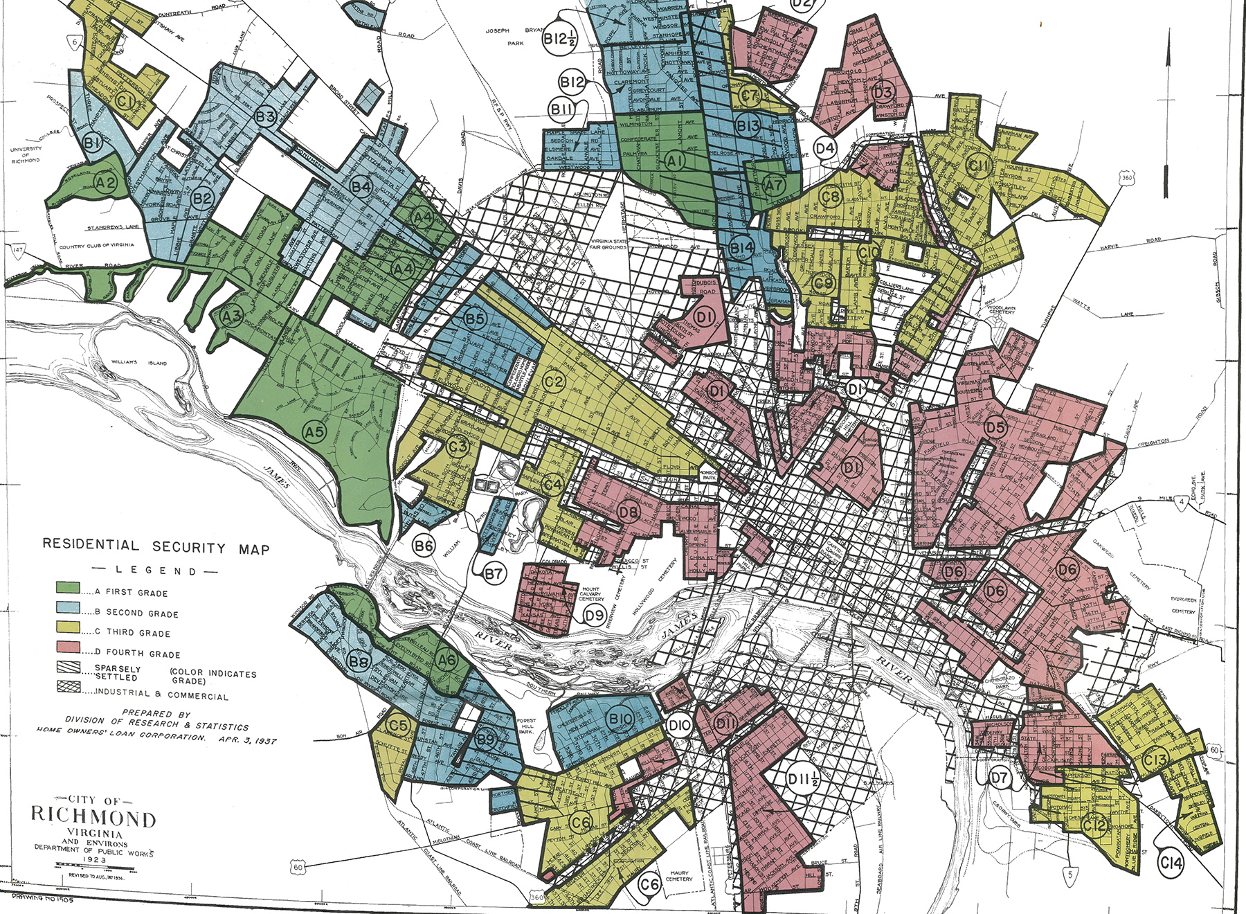
Richmond Residential Security map, 1923
From "Redlining Richmond", a project of the Digital Scholarship lab,
University of Richmond.
"In the late 1930s the Home Owners' Loan Corporation (HOLC), a New Deal agency created to refinance homes and prevent foreclosures, surveyed real estate trends in the nation's largest cities. Working with local lenders and realtors, they assessed neighborhoods using a number of factors ranging from terrain to income levels to the "infiltration of a lower grade population" (by which they meant African Americans, Jews, and immigrants). Using these assessments they assigned a grade for each neighborhood's "residential security." Green "A" neighborhoods were the "hot spots" where mortgages were deemed to be reasonably safe. On the other end of the spectrum, red "D" areas were "characterized by detrimental influences in a pronounced degree," and mortgages in these areas were considered much more risky. The HOLC produced maps for each city showing the grades for all areas."